Cueva de las Manos: How to Get There from Comodoro Rivadavia
Planning your trip and still not sure how to get to Cueva de las Manos? This rock-art site — a UNESCO World Heritage Site — is hidden in the heart of the Río Pinturas Canyon, far from the busiest routes.
Here we explain, step by step, how to get to Cueva de las Manos from Comodoro Rivadavia, with routes, distances, real travel times, road conditions and all the practical info on hours and admission for 2026.
In short: getting to Cueva de las Manos
From Comodoro Rivadavia you need to cover about 550 km to Cueva de las Manos, in two clearly different legs:
- Comodoro Rivadavia → Perito Moreno (Santa Cruz): about 376 km of pavement, between 4 and 5 hours of driving.
- Perito Moreno → Cueva de las Manos: about 175 km on National Route 40 and then Provincial Route 97, with a final gravel stretch.
In total, allow a full day of travel (between 7 and 8 hours of driving, not counting stops). This is not a route to rush: plan ahead, fill up on fuel at every opportunity and enjoy the scenery.
Leg 1: from Comodoro Rivadavia to Perito Moreno
The first leg takes you from the Chubut coast to the town of Perito Moreno, the gateway to this region of Santa Cruz.
From Comodoro Rivadavia take National Route 26 west toward Colonia Sarmiento, a good first stop. From there, continue merging onto National Route 40, which you follow south to Perito Moreno. It's about 376 km fully paved, covered in 4 to 5 hours, depending on wind and stops.
The town of Río Mayo serves as a midway gas station and rest stop: take the chance to fill up, because in Patagonia distances between fuel pumps are long. Perito Moreno is an excellent base to spend the night before the last leg, and also a connection point with Parque Patagonia, just 54 km away on the same Route 40.
Leg 2: from Perito Moreno to Cueva de las Manos
From Perito Moreno there are two ways to get there. The main, signposted route suitable for any vehicle goes through Bajo Caracoles:
- Take National Route 40 south from Perito Moreno. It's about 128 km of
pavement to the small settlement of Bajo Caracoles (another key
fuel stop).
In Bajo Caracoles, merge onto Provincial Route 97 north. It's 47 km of gravel covered in about an hour, with a final descent on a winding cliff-edge road down to the canyon.
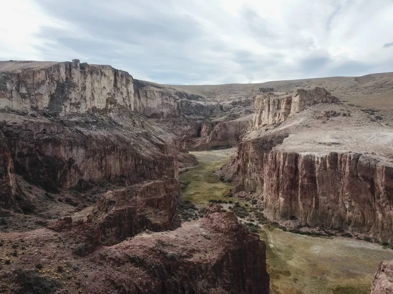
This last stretch is a gravel road, so drive carefully, slow down and keep your spare tire in good condition. The effort is worth it: the descent into the Río Pinturas Canyon, with the wall of hand paintings over 9,000 years old, is one of Patagonia's most thrilling postcards.
- There's also a north access via Provincial Route 97 and an option to arrive
on foot through Portal Cañadón Pinturas (a roughly 5 km high-difficulty
hike, only for those after the full trekking experience).
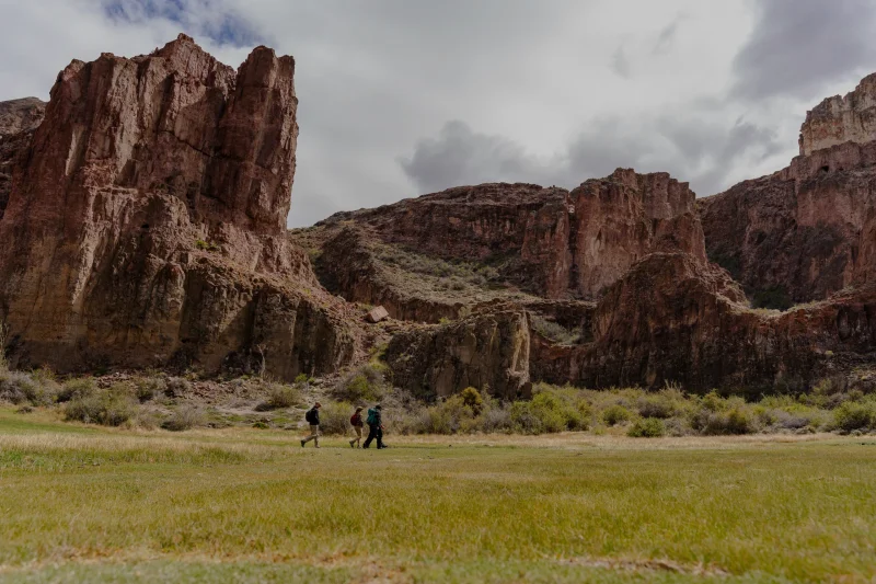
If you like this option, we recommend spending the night at the Portal, which has a lodge, a serviced campground with parking, and a general store. That way the day isn't so long, and on day two you can walk to Cueva de las Manos — an experience combining hiking, wildlife watching and archaeological sites.
Getting there without your own car
If you're not traveling in your own vehicle, the most practical way is to take a long-distance bus to Perito Moreno or Los Antiguos and, from there, book a guided tour to Cueva de las Manos. It's the easiest option to cover the gravel stretch and adds historical context with local guides. Check the options on our guided tours page.
Hours and admission to Cueva de las Manos (2026)
Cueva de las Manos is visited with a guide, at times that change by season:
- High season (October to April): 9 a.m. to 7 p.m.
- Low season (May to September): 10 a.m. to 5 p.m.
- Open every day, Monday to Sunday.
The site has an admission fee, with reduced rates for Argentine residents, retirees and local residents, and free entry for children under 12 and people with accredited disabilities. Since prices are updated frequently, we recommend confirming the current fee before your visit. The guided tour lasts about an hour and a half and includes a walk along the canyon edge to the painted rock shelters.
Tips for the trip
The best time to visit the region is October to April, when days are long and roads are in better condition. Patagonian weather is changeable and wind rules, so bring layered clothing, a windbreaker, comfortable shoes, sunscreen, water and something to eat. Review all our visit recommendations.
While you're in the area, take the chance to explore Parque Patagonia: over 80 km of trails, wildlife watching, climbing and astrotourism. Discover everything on the activities page and plan your stay with the where to stay options. For full details on routes and access to the region, visit our How to Get There guide.
Frequently Asked Questions
It's about 550 km in total: first 376 km of pavement on RN 26 and RN 40 to Perito Moreno, then about 175 km to the cave, taking RN 40 south to Bajo Caracoles and RP 97 (47 km of gravel) north.
Cueva de las Manos is about 175 km from Perito Moreno via the main route through Bajo Caracoles, roughly a 2 hour and 45 minute drive.
The National Route 40 stretch (Perito Moreno–Bajo Caracoles) is paved. The last 47 km, on RP 97 from Bajo Caracoles to the cave, are gravel: drive with caution.
In high season (October to April) it's open 9 a.m. to 7 p.m. and in low season (May to September) 10 a.m. to 5 p.m., every day. Admission is charged, with reduced rates for residents and free entry for children under 12. Check current prices before traveling.
Yes. You can take a long-distance bus to Perito Moreno or Los Antiguos and hire a guided tour, the most comfortable way to handle the gravel stretch.